Tehran Unveils Stunning New Geographical Atlas of the Persian Gulf
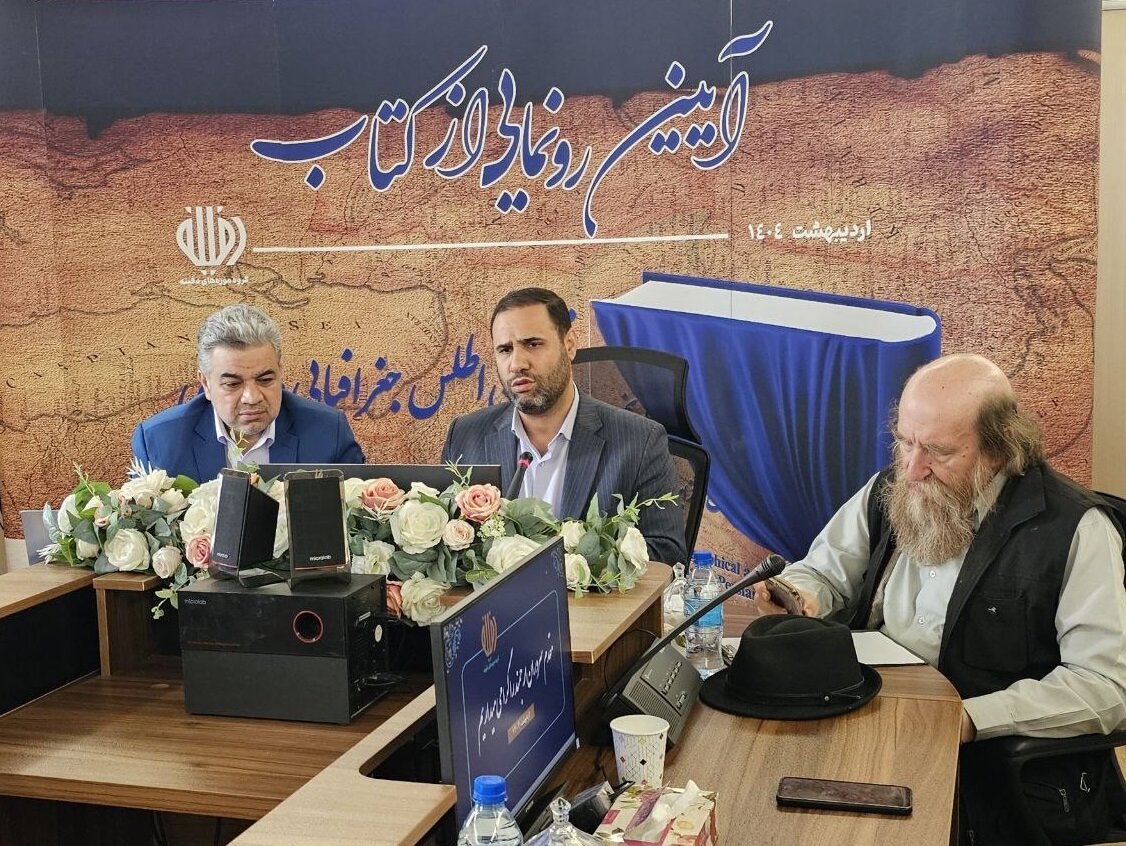
The unveiling of the first-ever geographical atlas of the Persian Gulf marks a pivotal moment in documenting the maritime heritage of this historically rich region. Held on Wednesday at the Mostazafan Foundation, the ceremony revealed a scholarly work that promises to enhance understanding and appreciation of the Persian Gulf’s historical significance.
Hamidreza Soleimani, CEO of the Dafeeneh Museums Institute, described the atlas as a representation of the oldest maritime culture in the world. The atlas features 35 historical maps crafted by European geographers over the last four centuries, providing an extensive overview of the region’s maritime legacy.
During the event, Soleimani stressed the scholarly rigor behind the atlas, stating, “This book serves as a critical academic reference and has been printed for the first time in book form. Given the sensitivity and historical weight of the subject, all maps included were carefully verified with relevant authorities and institutions.” This meticulous attention to detail underscores the importance of accuracy in historical documentation.
The atlas was compiled and published through a collaborative effort involving several key organizations, including:
- The Iranian Parliament’s Research Center
- The Armed Forces Geographical Organization
- Departments within the Ministry of Cultural Heritage
- The Ministry of Foreign Affairs
Soleimani also announced exciting future plans for the project. He revealed that additional volumes will be published based on available historical sources, further enriching the scholarly contributions to the understanding of the Persian Gulf.
In a significant development, Soleimani mentioned that 50 historical maps of the Persian Gulf, along with details of the three disputed islands, will soon be available for public viewing at the Dafeeneh Museum. This initiative aims to provide greater access to the region’s rich cartographic history.
While celebrating this cultural milestone, the event also included a moment of reflection, as attendees offered condolences for a recent incident at Shahid Rajaei Port in southern Iran. This somber acknowledgment highlighted the community’s solidarity during a time of cultural celebration.
The unveiling ceremony coincided with the annual observance of Persian Gulf National Day, which falls on the 10th day of Ordibehesht in the Iranian calendar, aligning with April 30 this year. This day is significant as it commemorates the region’s history, name, and cultural importance.
Furthermore, it marks the historic victory in 1622 when the combined forces of the Safavid Empire and the British East India Company successfully expelled Portuguese forces from the strategic Strait of Hormuz. This event is a testament to the enduring historical significance of the Persian Gulf as a vital maritime route.
In conclusion, the unveiling of the geographical atlas of the Persian Gulf is not just a scholarly achievement but also a celebration of the region’s rich maritime history. As more volumes are planned for the future, this initiative will undoubtedly contribute to a deeper understanding and appreciation of the Persian Gulf’s cultural and historical landscape.


