Revolutionary Aerial Mapping Unveils Jiroft’s Hidden Archaeological Treasures for the First Time!
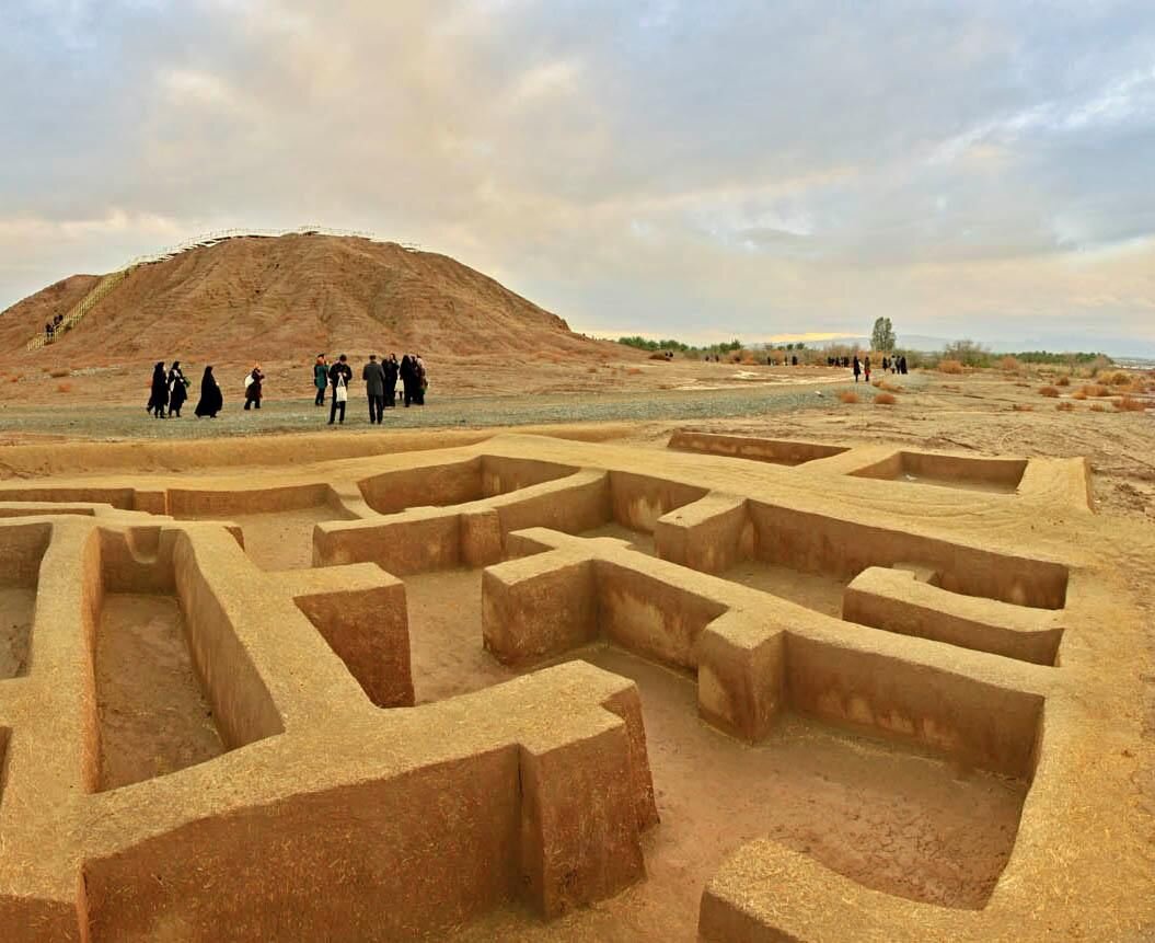
For the first time in history, aerial mapping and imaging have been carried out over the significant archaeological sites in Jiroft, a region celebrated for its Bronze Age ruins dating back to the 3rd millennium BC. This groundbreaking initiative represents a vital advancement in the documentation and preservation of one of Iran’s most historically rich areas, as noted by Ghader Shirvani, an official overseeing historical sites in southern Kerman province.
The aerial survey focused on the ancient city of Old Jiroft and the smaller site known as Qal’eh Kuchak (Small Fortress). Shirvani stated on Monday, “The project aims to enhance the documentation process and support ongoing archaeological and conservation efforts.” Situated in southern Iran, Jiroft is widely recognized as a cradle of civilization, holding invaluable historical and cultural significance.
“This is the first time such detailed aerial imaging and mapping have been done in the region,” Shirvani emphasized. The success of this project was made possible through collaboration with Agourchin Co., the contractor involved in the Jiroft airport project, which provided high-resolution photographs and video footage to facilitate the survey.
In March, Iran’s Minister of Cultural Heritage, Tourism, and Handicrafts, Seyyed Reza Salehi-Amiri, underscored the global importance of Jiroft’s ancient civilization. He urged for increased efforts to showcase its historical and cultural value to the world. Speaking during an administrative council meeting in Jiroft, Salehi-Amiri remarked, “Jiroft is not just an ancient city but a symbol of identity, history, and civilization. If other nations possessed such a civilization, they would build their national economy around it. Unfortunately, we have yet to fully present Jiroft’s civilizational value to the world.”
Jiroft is recognized as the heart of an early Bronze Age culture, often referred to as the Jiroft or Halilrud (Halil River) culture. This region is renowned for its distinctive artifacts and extensive urban settlements, illuminating one of the earliest civilizations in the area covering present-day Kerman and Sistan-Baluchestan provinces.
Remarkable discoveries in the Jiroft region date back to the early 21st century when severe floods along the Halil River unearthed numerous previously unknown tombs, revealing artifacts believed to date back to the Early Bronze Age (late 3rd millennium BC). Reports initially described the scene of “an ancient object floating on the water’s surface.” Villagers, affected by two years of drought, flocked to the riverbanks the following day to search for 5,000-year-old relics.
Despite its historical significance, geological factors have caused the site to be overlooked by tourists and archaeologists, who typically focused on locations like Mesopotamia, situated roughly 1,000 km away. Layers of sediment were washed away, exposing the remains of an ancient cemetery. Local residents and looters quickly recognized the importance of the find, leading them to collect and sell the artifacts they discovered.
A cultural heritage expert, Saeid Shahrokhi, stated that the Jiroft Plain is an interconnected expanse where various regions, including Dakyanus, Konar Sandal, and others, cannot be viewed in isolation. “Human life has persisted in this plain for thousands of years, making it a unique setting for historical continuity and cultural richness,” Shahrokhi explained.
- Significance of Aerial Mapping: The recent aerial survey marks a pivotal moment in the preservation efforts of Jiroft’s archaeological heritage.
- Collaboration: The project highlights the importance of partnerships, such as the one with Agourchin Co., in advancing archaeological documentation.
- Global Awareness: Officials stress the need for increased global awareness of Jiroft’s cultural heritage and its historical importance.
- Historical Richness: Jiroft is a symbol of historical continuity, showcasing the region’s extensive cultural legacy.
In conclusion, the pioneering aerial mapping and imaging project in Jiroft not only enhances the documentation of this rich archaeological site but also paves the way for future research and conservation efforts. As officials continue to advocate for the recognition of Jiroft’s significance, it becomes clear that this ancient city holds a treasure trove of history waiting to be uncovered. The ongoing efforts to document and preserve its legacy will ensure that Jiroft’s cultural richness is acknowledged and celebrated on a global stage.
